How to Get to Zion National Park: Airports, Roads and Getting Around
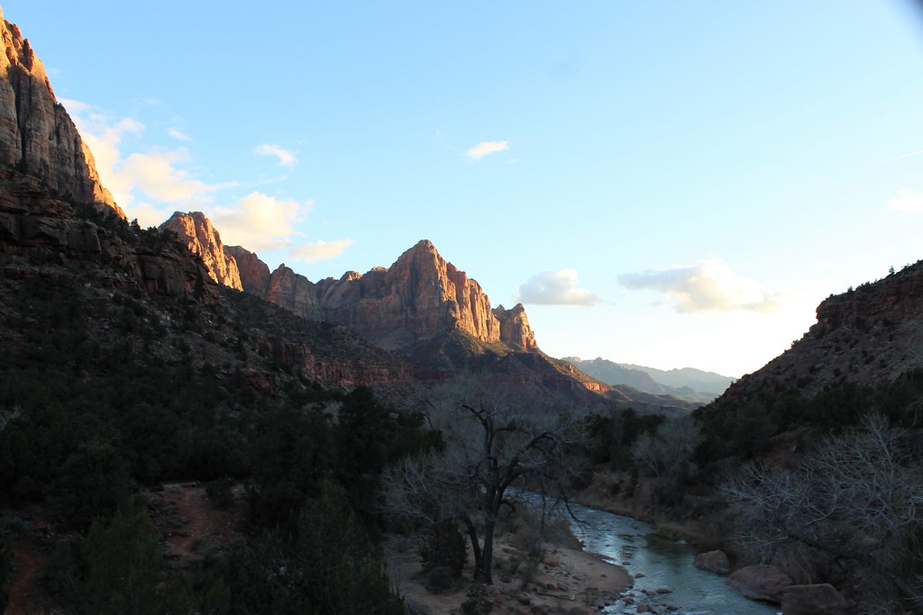
Photo: agcaddesigns.com Architectural Renderings via Flickr (CC BY 2.0)
How Get Zion National Park becomes an immediate question at sunrise in Springdale, when the first light reaches the 7,220-foot West Temple and cool air drains from Zion Canyon. Pavement lies underfoot, shuttle brakes hiss along Zion Park Boulevard, and sandstone walls rise abruptly above the town. The scale explains why a destination that looks compact on a map requires careful transportation planning. Zion sits in southwestern Utah, roughly between Las Vegas and Salt Lake City, with its primary visitor gateway at Springdale. Most travelers fly into Las Vegas, Salt Lake City, St. George, or Cedar City.
Zion sits in southwestern Utah, roughly between Las Vegas and Salt Lake City, with its primary visitor gateway at Springdale. Most travelers fly into Las Vegas, Salt Lake City, St. George, or Cedar City, then continue by rental car or prearranged ground transportation. The correct route depends on flight availability, season, vehicle size, and which section of the park you intend to visit.
How to Get to Zion National Park: Best Airports and Transfers
Harry Reid International Airport in Las Vegas usually provides the broadest flight selection, while St. George Regional Airport minimizes driving. Salt Lake City International Airport can work well for a longer Utah road trip involving Bryce Canyon, Capitol Reef, or the North Rim region of Grand Canyon. Cedar City Regional Airport is geographically convenient, but its smaller flight network can make connections less flexible.
| Airport | Approximate distance to Springdale | Typical nonstop driving time | Best use |
|---|---|---|---|
| St. George Regional Airport | 48 miles | 1 hour | Shortest road transfer |
| Cedar City Regional Airport | 60 miles | 1 hour 10 minutes | Regional flights and northern Utah itineraries |
| Harry Reid International Airport, Las Vegas | 170 miles | 2 hours 45 minutes | Flight choice and rental car availability |
| Salt Lake City International Airport | 310 miles | 4 hours 30 minutes | Multi-park Utah road trips |
These estimates end in Springdale rather than at a generic park boundary. Add time for fuel, food, rental car collection, traffic through Hurricane and La Verkin, and any line at Zion’s South Entrance. Summer weekends, holiday periods, and Sunday return traffic toward Las Vegas can materially lengthen the journey.
How to Get to Zion National Park from Las Vegas by Road
From Las Vegas, take Interstate 15 north through the Mojave Desert, cross a corner of Arizona through the Virgin River Gorge, and enter Utah near St. George. Continue toward Hurricane, then follow Utah State Route 9 through La Verkin, Virgin, Rockville, and Springdale. The Virgin River Gorge is a winding interstate segment with steep rock walls, construction zones, and limited places to stop.
Nevada uses Pacific Time and Utah uses Mountain Time. Travelers lose one clock hour when driving to Zion, a detail that matters for rental counters, lodging check-in, dinner service, and daylight. Las Vegas is generally the most practical airport for international arrivals and late flight schedules, but landing late at night can turn the final drive into a tiring desert crossing.
Regional Airports in St. George and Cedar City
St. George Regional Airport lies southeast of St. George. The drive reaches Springdale through Hurricane and State Route 9, avoiding the Zion-Mount Carmel Tunnel. It is the simplest airport choice for visitors staying in Springdale and concentrating on Zion Canyon, provided the flight schedule and fare suit the trip.
Cedar City sits beside Interstate 15 north of the park. The usual approach runs south on the interstate, then turns toward Toquerville, La Verkin, and State Route 9. Cedar City is also useful for combining Zion with Cedar Breaks National Monument or Kolob Canyons, although winter weather affects the high roads around Cedar Breaks much more than the lower Springdale corridor.
How to Get to Zion National Park from the Airport
No airport has a direct National Park Service shuttle to Zion. Commercial transfers may connect regional cities with Springdale, but they require advance scheduling and may not align with early departures or delayed flights. A rental car gives the greatest flexibility for reaching trailheads outside Zion Canyon, buying groceries, and continuing to Bryce Canyon or the park’s east side.
Getting Around Zion National Park With or Without a Rental Car
Visitors staying in central Springdale can sometimes arrange an airport transfer and use local pedestrian connections plus the seasonal shuttle systems. This works best for an itinerary focused on Zion Canyon destinations such as Emerald Pools, the Grotto, Angels Landing, and the Riverside Walk. A car remains useful for Kolob Canyons, Kolob Terrace Road, the east entrance, and sunrise or sunset locations beyond shuttle service.
Use this sequence when booking the trip:
- Choose an airport based on the complete flight and driving schedule, not mileage alone.
- Check whether the rental counter remains open after the scheduled arrival.
- Reserve a vehicle with enough luggage space and suitable tires for the season.
- Save offline maps before leaving the airport because mobile coverage weakens near the park.
- Plan fuel and food stops in St. George, Hurricane, La Verkin, Cedar City, or Springdale.
Build a Delay Buffer into Arrival Day
A same-day flight followed by a major hike creates avoidable pressure. Angels Landing requires a permit, while the Narrows depends on river flow, weather, and flash-flood risk. Even permit-free walks can become impractical after baggage delays and the drive. Our team recommends treating arrival day as transportation time, with a short walk such as the Pa’rus Trail only if daylight and conditions allow.
Carry water in the vehicle year-round. Summer temperatures along Interstate 15 and State Route 9 regularly create punishing conditions during roadside delays, while winter nights can fall below freezing. A charging cable, downloaded reservation details, sunglasses, and a warm layer belong in the passenger compartment rather than buried under luggage.
How to Get to Zion National Park by Road: Choosing an Entrance
Zion has several geographically separate access points. The South Entrance at Springdale serves Zion Canyon and receives most visitors. The East Entrance lies on State Route 9 near the high sandstone country east of the canyon. Kolob Canyons has its own entrance from Interstate 15 and does not connect internally by road with Zion Canyon.
South Entrance and the Springdale Corridor
Travelers arriving from Las Vegas, St. George, Cedar City, or Salt Lake City generally approach the South Entrance through Springdale. Zion Canyon’s floor stands near 4,000 feet, while surrounding walls and plateaus rise several thousand feet higher. Parking fills early during busy periods, so lodging within walking distance of a Springdale shuttle stop can remove the need to move a vehicle each morning.
State Route 9 is the main street through Springdale before entering the park. Expect pedestrians, cyclists, shuttle traffic, narrow access points, and reduced speeds. Large RVs should identify an appropriate parking plan before reaching town rather than searching for space near the entrance.
East Entrance and the Zion-Mount Carmel Highway
The East Entrance is reached from U.S. Route 89 at Mount Carmel Junction. State Route 9 then crosses checkerboard sandstone, slickrock drainages, and higher terrain before descending toward Zion Canyon. This approach is especially logical from Bryce Canyon, Kanab, Page, or the North Rim region, though snow and ice are more likely on the elevated east side than in Springdale.
Plan Carefully for the Zion-Mount Carmel Tunnel
The 1.1 mile Zion-Mount Carmel Tunnel opened in 1930 and contains curves, limited clearance, and no pedestrian or bicycle access. Oversize vehicles may require traffic control and are subject to dimensional restrictions. Shuttle operations, entrance requirements, tunnel procedures, fees, and road restrictions can change, so confirm current details on the official park site before driving an RV, bus, trailer, or unusually tall vehicle.
Kolob Canyons Is a Separate Arrival
Kolob Canyons is reached directly from Interstate 15 near Exit 40, north of the routes into Springdale. Its scenic road accesses crimson finger canyons and the trailhead for the 14 mile round-trip hike to Kolob Arch. There is no road through the park from Kolob Canyons to Zion Canyon, so visitors must return to Interstate 15 and drive around the park to reach Springdale.
Getting Around Zion National Park and Springdale
During the park shuttle season, private vehicles generally cannot continue along Zion Canyon Scenic Drive beyond Canyon Junction unless their occupants are staying at Zion Lodge. Drivers park in Springdale or near the visitor center, then transfer to the canyon shuttle. Outside the operating season, private vehicles may usually enter the scenic drive until parking spaces fill. The practical answer to How Get Zion National therefore changes with the date, even when the airport and highway route remain identical.
Understand the Two Shuttle Systems
The Springdale shuttle travels along Zion Park Boulevard and connects lodging areas with the pedestrian entrance near the visitor center. After entering the park, passengers board a separate Zion Canyon shuttle serving locations such as Zion Lodge, the Grotto, Weeping Rock, Big Bend, and the Temple of Sinawava. Build transfer time into any permit schedule. Queues are longest around morning hiking departures and near the final afternoon return from the upper canyon.
| Travel method | Best application | Primary limitation |
|---|---|---|
| Park shuttle | Zion Canyon trailheads | Queues and seasonal operation |
| Springdale shuttle | Reaching the pedestrian entrance | Requires a transfer into the park system |
| Bicycle | Flexible travel along the scenic drive | Heat, climbing, and shuttle traffic |
| Private vehicle | East Zion, Kolob Terrace, and Kolob Canyons | Parking pressure and seasonal road controls |
Use Walking or Cycling for Short Connections
The Pa’rus Trail provides a paved route between the visitor center and Canyon Junction, covering about 1.7 miles each way beside the Virgin River. Cyclists can continue into Zion Canyon when vehicle access is restricted, but the road gains elevation toward the Temple of Sinawava and summer heat increases the effort. Riders must stop safely when a shuttle approaches from behind and allow it to pass. Carry lights if an evening return could extend beyond daylight.
Avoid Transportation Mistakes That Cost Trail Time
The most common planning error is treating the park entrance as the final destination. Reaching Springdale still leaves parking, entrance, shuttle transfer, and trailhead travel. A hike beginning at the Grotto or Temple of Sinawava can require substantial additional time after arrival in town. Keep lodging addresses, permit documents, and trailhead names downloaded offline. Mobile reception becomes inconsistent inside the canyon, especially beneath the Navajo Sandstone walls.
Start Before the Main Morning Rush
At the Temple of Sinawava, the canyon feels markedly cooler than Springdale. The paved Riverside Walk begins beneath cottonwoods, with sandstone underfoot and the Virgin River audible beside the path. Overhead, walls narrow toward the Narrows and block direct sun for part of the morning. That temperature difference is useful in summer, but it can conceal how hot the return journey will become. Carry enough water for the later conditions rather than the cool start.
Match the Vehicle to Seasonal Conditions
Winter storms can leave snow or black ice on the east side of State Route 9 while roads around Springdale remain wet or dry. Summer thunderstorms create a different problem: flash flooding can close trails and make narrow canyons dangerous even when rain falls miles away. High winds also affect tall vans, trailers, and roof cargo on exposed highways. Check weather for Springdale, the east entrance, and the route between them because elevation changes create sharply different conditions.
Keep a Simple Arrival Backup Plan
A delayed flight, full parking area, or temporary road closure should change the day’s objective rather than trigger a rushed hike. Prepare these alternatives before departure:
- Store an offline route to both the South and East entrances.
- Keep one low-commitment walk available for arrival day.
- Place water, medication, layers, and charging equipment within reach.
- Know where the next fuel stop lies before entering remote park roads.
- Leave enough schedule flexibility to move a major hike to another morning.
Choose the Route That Fits the Actual Trip
Las Vegas generally provides the strongest combination of flights and rental vehicles, St. George minimizes road time, and Salt Lake City suits a broader Utah itinerary. From there, choose the entrance serving the places you intend to visit. Springdale is the logical base for Zion Canyon, Mount Carmel Junction serves the east approach, and Interstate 15 provides independent access to Kolob Canyons.
Once in Springdale, separate the journey into manageable stages: park the vehicle, reach the pedestrian entrance, transfer to the canyon shuttle, and allow time for the ride to the correct stop. Travelers who account for elevation, seasonal road conditions, tunnel restrictions, and shuttle transfers arrive with enough daylight and energy for the park itself. That preparation turns a complicated transportation map into a clear sequence of decisions.
Want to keep exploring? Browse all our Zion guides and articles for more trip-planning tips and ideas.
Gear & Essentials
Tell us about your trip and we will add what else you will want:
The basics
Worth having in the car whatever the park.
For this trip
Traveling with kids
Bringing a pet
RVing
Backcountry
Winter conditions
On the water
Photography
Accessibility
As an Amazon Associate we earn from qualifying purchases, at no extra cost to you.